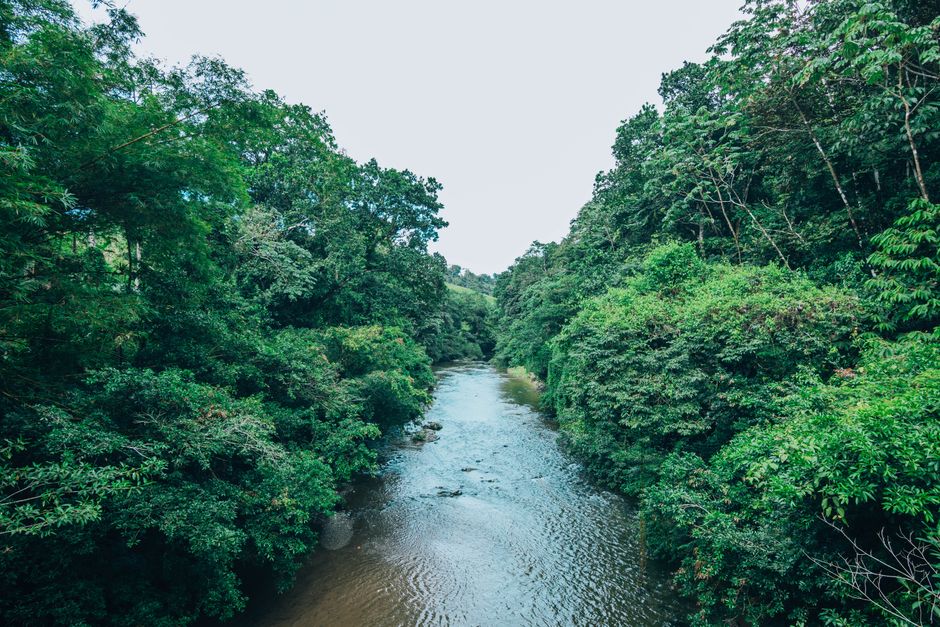
Rainforest rivers are not static features. After spending years moving through and alongside them – planning logistics, timing expeditions, waiting out weather – you learn that a river in dry season bears almost no resemblance to the same waterway three months into the rains. The difference is not merely a matter of water level. The entire character of the river shifts: its speed, its navigability, the hazards it presents, and the rhythm of human movement along it.
Most people who haven’t worked in rainforest environments assume that a river is a river. They imagine it as a consistent corridor through the forest. The reality is messier. A river in the Amazon basin, the Congo, or Southeast Asian tributaries operates under seasonal constraints that dictate when you can move upstream, when you must abandon certain routes entirely, and when the landscape itself becomes unreliable.
The Dry Season Advantage
During the dry months, rainforest rivers become narrower and shallower. Water levels drop significantly – sometimes by 30 to 50 feet in major systems – exposing sandbars, rocks, and debris that remain hidden during high water. This sounds like a disadvantage, but it’s actually when many rivers become most accessible for certain types of movement.
Smaller boats and dugout canoes can navigate more easily because the water, though shallower, moves with less chaotic force. You can see obstacles ahead. The current is predictable. Local communities use dry season windows to move goods, visit distant settlements, and maintain trade routes that would be impossible or dangerous during floods. I’ve watched river traders time their journeys with precision during these months, knowing that a two-week window exists before water levels shift again.
The exposed riverbed also reveals the river’s true structure. Channels become apparent. You can identify which sections are prone to logjams, where debris accumulates, and which bends hold the deepest water. This knowledge is practical and essential. A boatman who knows a river in dry season can navigate it more confidently, even when conditions change.
But there’s a cost. Dry season also means lower humidity in some regions, which can affect forest ecology and water quality. Some tributary streams dry up entirely, cutting off communities that depend on them for water and transport. The river becomes a series of isolated pools rather than a continuous waterway. Movement between settlements that are connected by water in wet season requires overland routes when the rains stop.
The Wet Season Transformation
When the rains intensify, rivers swell rapidly. The transformation happens over weeks, not months. Water levels rise, and the river’s character changes fundamentally. The current accelerates. Debris – fallen trees, branches, vegetation – enters the water and moves downstream with dangerous speed. The river becomes wider, darker, and far more powerful.
In wet season, large rivers become highways for movement. Boats that would struggle in shallow water now have deep channels. Larger vessels can navigate routes that are impassable in dry season. The Amazon’s main channel, for example, becomes genuinely navigable for ocean-going ships during flood season. Communities that are isolated by land become connected by water. Trade and movement that requires boats intensifies.
However, the hazards multiply. Whirlpools form where currents collide. Floating vegetation mats – sometimes acres in size – block passages and can trap boats. Visibility drops. The water moves so quickly that if you capsize or lose control, recovery becomes extremely difficult. I’ve seen experienced boatmen refuse to travel certain sections during peak flood, not from caution but from realistic assessment of risk. The river is moving too fast, carrying too much debris, and the margin for error disappears.
Flooding also inundates the forest floor. Trees that stand on dry land become partially submerged. The boundary between river and forest blurs. This creates opportunities for certain types of travel – you can navigate through flooded forest where there is no defined channel – but it also means losing visual landmarks and the ability to judge distance or direction. Navigation becomes dependent on knowledge of the landscape rather than following a visible waterway.
The Transition Periods
The shift from dry to wet and back again is not gradual. There are weeks when the river is in flux. Water levels rise or fall noticeably day to day. The current becomes unpredictable. Debris loads fluctuate. These transition periods are often when accidents happen because conditions are neither one thing nor another. A boatman accustomed to dry season water levels may misjudge a rising river. Someone expecting wet season conditions may be caught off guard by a sudden drop in water.
Local communities are attuned to these transitions in ways that outsiders rarely are. They watch the forest, the sky, and the water itself for signals. They know when the rains are beginning to ease or intensify. They time their movements accordingly. This knowledge is accumulated over generations and is specific to each river system. What works on the Rio Negro does not necessarily apply to the Orinoco, even though both are major Amazonian systems.
Ecological Shifts and Access
Seasonal changes affect not just water movement but the entire ecosystem. Fish populations shift. Some species move into flooded forests during wet season to feed and breed. Others concentrate in deeper pools during dry season. This affects fishing communities and the food security of settlements that depend on river resources.
Vegetation responds to water levels as well. Trees and plants adapted to seasonal flooding grow and reproduce in sync with the river’s rhythm. During dry season, you see the forest floor and the base of trees. During wet season, the forest becomes a three-dimensional labyrinth of water, roots, and vegetation at multiple levels. This affects wildlife movement, hunting patterns, and the overall accessibility of the forest itself.
For travelers and expeditions, these ecological shifts matter because they determine what is possible. A research team that needs to access the forest floor can only do so during dry season. A team studying fish populations needs to be present when those populations are concentrated or dispersed. Timing is not optional; it is a fundamental constraint.
Practical Navigation Reality
In my experience, the most common mistake people make is underestimating how dramatically a river changes. They assume that if they can navigate it in one season, they can navigate it in another. This is rarely true. A river that is straightforward in dry season becomes a puzzle in wet season. A route that is impassable in dry season becomes the primary highway in wet season.
Local boatmen adjust their techniques seasonally. They use different boats, different routes, and different timing strategies. They understand the river’s seasonal personality and work within its constraints rather than against them. This is not something you can learn from a map or a guidebook. It requires time on the water and conversations with people who have spent years navigating these systems.
The seasonal rhythm of rainforest rivers is not an obstacle to be overcome. It is a fundamental feature of how these landscapes function. Understanding it – really understanding it – means recognizing that access, movement, and logistics are not fixed. They are negotiated with the river itself, which operates on a schedule that predates human planning and will outlast any single expedition or journey.