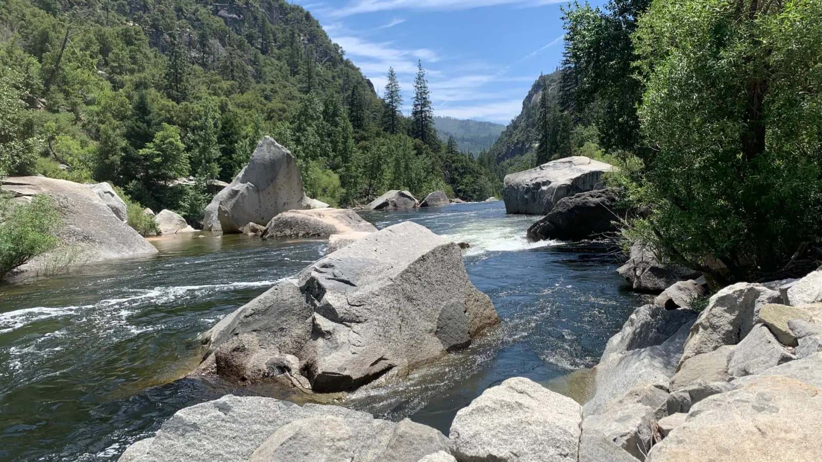
The Babinda Boulders sit in a narrow gorge carved by Babinda Creek, roughly an hour inland from Cairns in Far North Queensland. The boulders themselves are the obvious draw – massive granite formations stacked and wedged into the creek bed, creating pools and chutes that invite exploration. But the actual experience of being there depends far more on understanding the forest and the water than on the rocks themselves.
I’ve walked this area dozens of times across different seasons, and what strikes me most is how many people arrive with an incomplete picture. They expect a scenic walk to some interesting rocks. What they encounter is a subtropical rainforest with its own rhythm, its own hazards, and its own way of revealing itself depending on when you show up.
The Walk In and What It Tells You
The main track from the car park to the boulders is well-maintained and roughly 1.5 kilometers one way. It’s not steep, which is why people often underestimate the cumulative effect of the environment. The path winds through dense vegetation, and the canopy is thick enough that direct sunlight rarely reaches the ground. This matters more than it sounds.
The track stays damp even on days when it hasn’t rained recently. The forest floor doesn’t dry out the way open ground does. Moisture sits in the leaf litter, on exposed tree roots, and in the compacted soil. Footwear with decent grip becomes non-negotiable, not optional. I’ve watched people in smooth-soled shoes struggle on sections that aren’t technically difficult but are genuinely slippery. The real issue isn’t the gradient – it’s the combination of moisture, root systems, and the way the track surface changes texture without warning.
The walk also gives you a sense of isolation that intensifies as you move deeper into the gorge. The creek sound builds gradually, and the vegetation closes in. Mobile phone reception is patchy to nonexistent depending on your network. This isn’t a crisis point, but it’s worth acknowledging. If someone needs help, they’re not calling for it from the boulders themselves.
Water Conditions and Why They Matter
The creek is the real variable here. After heavy rain, it transforms completely. The pools that are normally inviting become dangerous – water moves fast, visibility drops, and the current has genuine force. I’ve seen the creek go from placid to aggressive in a matter of hours after upstream rainfall.
This is where local knowledge becomes practical rather than theoretical. During the wet season (November through March), the creek can be impassable without risk. Outside that window, conditions are more predictable, but “predictable” doesn’t mean static. A storm twenty kilometers inland can affect water levels and flow within an hour.
The boulders themselves create a maze of passages, some of which funnel water into tight channels. If you’re exploring beyond the main viewing area, you need to understand how water moves through the system. The granite is smooth and can be slippery even when dry – when wet, it becomes genuinely treacherous. People slip here regularly. Most don’t get seriously hurt, but the potential is real.
Thermal and Physical Demands
The rainforest is cooler than the surrounding landscape, which sounds pleasant until you’re wet and there’s no direct sun to dry you out. If you’re swimming or wading, you can cool down faster than you expect. The water temperature is cold year-round – it’s fed by upstream springs and shaded by the canopy. Immersion in cold water after exertion is a combination worth respecting.
The humidity is another factor that accumulates over time. The air is saturated, and your body’s cooling mechanisms don’t work as efficiently as they do in drier environments. People often don’t drink enough water because they don’t feel as thirsty, even though they’re sweating and losing fluids. I’ve seen visitors become fatigued or disoriented partly because of dehydration in an environment that doesn’t obviously signal the need for water.
The walk itself isn’t long or particularly steep, but the combination of humidity, uneven footing, and the psychological effect of being in a confined gorge means people tire more quickly than they would on a similar track in open country. This is worth planning for, especially if you’re visiting with children or older adults.
Seasonal Patterns and Timing
Dry season (May through September) offers the most reliable conditions. Water levels are lower, the creek is safer to enter, and the track is less saturated. Temperatures are also more moderate, though “moderate” in North Queensland still means warm. This window is when most visitors come, and it shows – the car park fills early, and the track becomes crowded.
The shoulder seasons (April, October) can be excellent if you’re flexible. Fewer people, still-reasonable conditions, and the forest is actively growing, which means the vegetation is lush and the light filtering through the canopy is at its best. The trade-off is slightly higher humidity and the possibility of sudden rain.
The wet season is not the time to explore the boulders themselves. The creek dominates the landscape, and the risks outweigh the experience. The track remains walkable, but the gorge becomes a different place – louder, more powerful, and genuinely hazardous if you venture beyond the main viewing area.
What People Overlook
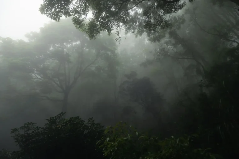
Most visitors focus on the boulders as a destination, but the forest itself is what shapes the actual experience. The canopy structure, the density of undergrowth, the way light moves through the trees – these create the atmosphere and the practical constraints.
Insects are present but rarely problematic if you’re moving. Mosquitoes can be active, especially near the creek at dawn and dusk. Leeches are a possibility during and after rain, though they’re more of a nuisance than a threat. I’ve encountered them dozens of times and they’re easily removed, but they unsettle people who aren’t expecting them.
The rocks themselves are attractive for photography, but the lighting is challenging. The gorge is narrow, the canopy is dense, and the contrast between shadow and the small patches of direct light creates exposure problems for cameras. Phone cameras handle this reasonably well. Traditional cameras often struggle. This is a minor point but worth knowing if you’re planning to document the visit.
Navigation is straightforward on the main track, but if you venture onto side trails or explore the boulder field itself, it’s easy to lose your bearings. The rocks look similar from different angles, and the sound of the creek can make it hard to judge distance and direction. Staying on marked routes or moving slowly and deliberately through the boulders keeps this from becoming an issue.
The experience of Babinda Boulders is ultimately shaped by respect for the environment and realistic expectations. The rocks are impressive, the forest is beautiful, and the creek is genuinely powerful. Understanding how these elements interact – how water moves, how the forest functions, how your body responds to the conditions – is what separates a good visit from a difficult one. The boulders themselves aren’t going anywhere, but the conditions around them change constantly.