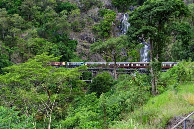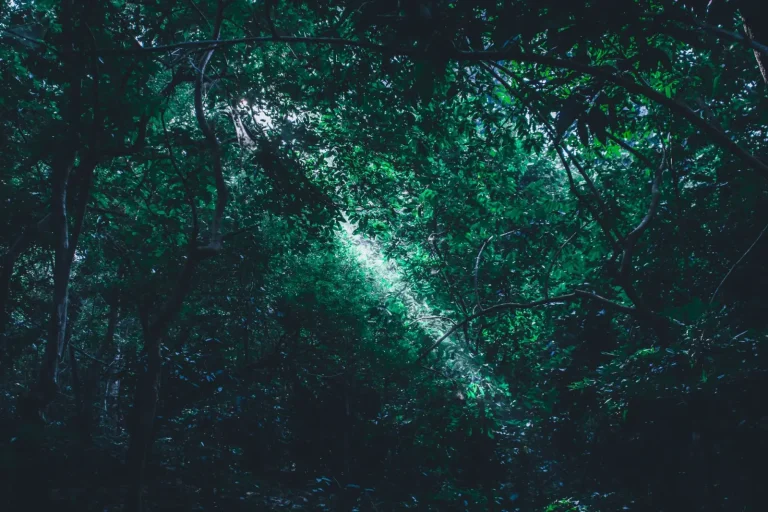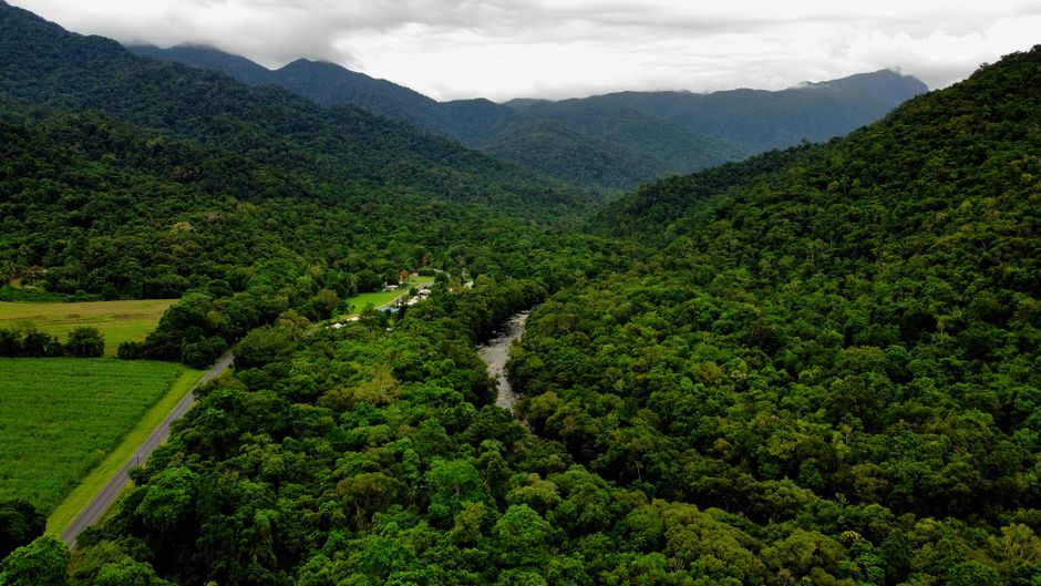
The rainforests of far north Queensland occupy a particular place in Australian travel. They’re neither as accessible as the east coast beaches nor as remote as the outback, which creates a specific kind of friction between expectation and reality. I’ve spent considerable time moving through these landscapes – on foot, by vehicle, and occasionally by boat – and what strikes me most is how the environment itself dictates the pace and character of any visit.
The region stretches from Cairns inland toward the Atherton Tablelands and down toward Mission Beach, encompassing several distinct forest types. What people often don’t grasp until they arrive is that “rainforest” here doesn’t mean a single uniform ecosystem. The wet tropical rainforest near the coast differs substantially from the drier, more open eucalypt-dominated forests at higher elevation. This variation matters because it changes what you actually see, how long movement takes, and what physical demands the landscape places on you.
Humidity is the first thing that reshapes your plans. It’s not merely uncomfortable; it directly affects how your body functions and how quickly fatigue accumulates. In the coastal lowlands, humidity regularly sits above 80 percent even outside the wet season. This means that moderate exertion – a two-hour walk that would feel manageable in a temperate forest – becomes noticeably harder. Your sweat doesn’t evaporate efficiently, so cooling becomes less effective. People often underestimate this and plan activities that sound reasonable on paper but feel genuinely taxing in practice.
Terrain and Movement
The actual ground beneath your feet varies more than many travelers anticipate. Near the coast and in the lowlands, the forest floor is often soft and unstable – a mix of decomposing vegetation, root systems, and sometimes waterlogged areas. Walking isn’t difficult in a technical sense, but it’s slower and more tiring than equivalent distance on firm ground. Your legs work harder with each step because the surface gives slightly with each footfall. Over a full day, this accumulates into genuine fatigue.
Higher elevation areas around the Atherton Tablelands present different challenges. The terrain can be steeper, and the forest canopy is sometimes more open, which means exposure to direct sun in patches. The soil tends to be firmer, which is a relief, but the gradient means your cardiovascular system works harder. I’ve watched people who are fit at sea level struggle with elevation that’s only around 600 to 900 meters because they underestimated the combination of gradient, humidity, and unfamiliar terrain.
Rock formations appear throughout the region, particularly in areas like the Daintree and around the Tablelands. These aren’t dramatic cliff faces, but rather scattered boulders and rocky outcrops that break up the forest floor. They’re slippery when wet, which is frequently. The region receives substantial rainfall year-round, and the wet season from December through March brings intense downpours that can last for days. Even in the dry season, moisture lingers in shaded areas and on rock surfaces.
Timing and Seasonal Patterns
The wet season fundamentally changes what’s possible. Between December and March, certain tracks become impassable, not because they’re flooded permanently but because they’re dangerous when wet. Creeks swell quickly, and the soft ground becomes treacherous. I’ve seen people turn back from what they thought would be straightforward walks because conditions deteriorated faster than expected. The wet season also brings insects in numbers that genuinely affect your ability to move comfortably – not just annoyance, but actual physical interference with visibility and breathing.
The dry season, roughly May through October, is when most travel happens. Conditions are more stable, but “dry” here is relative. Morning mist and occasional rain still occur, and the ground remains damp in shaded sections. The advantage is predictability. You can plan a day’s movement with reasonable confidence that weather won’t force a sudden retreat. Even so, afternoon heat during the middle months can be intense, particularly in open areas or at higher elevations where tree cover is thinner.
Early morning movement is almost always preferable. The air is cooler, humidity feels slightly more manageable, and you finish strenuous activity before midday heat peaks. Starting at dawn sounds obvious, but the reality is that reaching a trailhead early requires staying somewhere close enough to do so – which means either camping nearby or accepting that you’ll be driving in darkness. Many people don’t factor this into their planning.
What the Forest Actually Provides and Withholds
The biodiversity is genuine, but seeing it requires patience and often luck. Large animals are present but largely nocturnal or shy. You might walk for hours and see no mammals at all. Bird calls are constant, but identifying species requires knowledge or a guide. Insects are everywhere – which some find fascinating and others find overwhelming. Leeches appear in wet areas and attach themselves with persistent efficiency. They’re not dangerous, but they’re unpleasant, and removing them requires care to avoid infection.
Water sources exist throughout the region, but they’re not always where you expect them. Creeks and streams are common, but the water is often tannin-stained from decomposing vegetation, which is safe but tastes distinctly of the forest. Carrying water is necessary for any extended movement, which adds weight and requires planning around refill points.
Navigation can be surprisingly difficult. The dense canopy means GPS signals are unreliable in many areas. Marked trails are common near popular destinations like Cairns and Mission Beach, but they can be poorly maintained, and trail markers are sometimes hard to spot in the visual complexity of the forest. I’ve seen experienced hikers take wrong turns on supposedly well-marked tracks simply because the forest itself is visually overwhelming and the markers blend into the background.
Practical Realities of Access
Getting to the rainforest requires either a vehicle or reliance on limited public transport. Most meaningful forest access points are not within walking distance of towns. Driving is the default, which means dealing with roads that range from sealed highways to rough gravel tracks. Some areas are accessible only during the dry season when creek crossings are passable. The roads themselves can be slow – winding through mountainous terrain, sometimes single-lane with limited visibility.
Accommodation near forest areas varies significantly. Cairns and Mission Beach have standard tourism infrastructure. Smaller towns and villages have basic options. If you want to be positioned for early morning forest access, you might need to stay somewhere with limited amenities or drive in the dark. This isn’t a criticism of the region, but rather a constraint that shapes how visits actually unfold.
Guides are valuable here, not because the forest is inherently dangerous, but because they dramatically change what you actually perceive. A guide who knows the forest can point out camouflaged animals, explain the relationships between plant species, and navigate more efficiently. Without a guide, you see a forest. With one, you begin to understand it as a system. The difference is substantial enough to affect whether a visit feels rewarding or simply tiring.
The rainforests of far north Queensland are genuinely remarkable landscapes, but they operate on their own terms. They demand respect for humidity, terrain, and timing. They reward patience and early starts. They’re less forgiving of overconfidence than many Australian environments because the physical demands are subtle – not dramatic, but cumulative. Understanding this gap between expectation and reality is what separates visits that feel manageable from those that become ordeals.